


Haymow Precinct, Stanton County, Nebraska
About
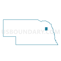
Outline

Summary
| Unique Area Identifier | 613960 |
| Name | Haymow Precinct |
| County | Stanton County |
| State | Nebraska |
| Area (square miles) | 36.12 |
| Land Area (square miles) | 36.08 |
| Water Area (square miles) | 0.04 |
| % of Land Area | 99.90 |
| % of Water Area | 0.10 |
| Latitude of the Internal Point | 41.88070800 |
| Longtitude of the Internal Point | -97.08260820 |
Maps


Graphs
Select a template below for downloading or customizing gragh for Haymow Precinct, Stanton County, Nebraska


Neighbors
Neighoring Voting District (by Name) Neighboring Voting District on the Map
- Butterfly Precinct, Stanton County, NE
- Kingsburg Precinct, Stanton County, NE
- Maple Creek Precinct, Stanton County, NE
- Ramshorn Precinct, Stanton County, NE
- Stanton A Precinct, Stanton County, NE
- SW 4, Cuming County, NE
- Wisner, Blaine & Grant Precinct, Cuming County, NE
Top 10 Neighboring County Subdivision (by Population) Neighboring County Subdivision on the Map
- Stanton precinct, Stanton County, NE (208)
- Lincoln township, Cuming County, NE (199)
- Bismark township, Cuming County, NE (178)
- Wisner township, Cuming County, NE (158)
- Ramshorn precinct, Stanton County, NE (152)
- Maple Creek precinct, Stanton County, NE (151)
- Haymow precinct, Stanton County, NE (137)
- Butterfly precinct, Stanton County, NE (128)
- Kingsburg precinct, Stanton County, NE (114)
Top 10 Neighboring Unified School District (by Population) Neighboring Unified School District on the Map
- Wisner-Pilger Public Schools, NE (2,559)
- Stanton Community Schools, NE (2,455)
- Clarkson Public Schools, NE (1,297)
- Howells Public Schools, NE (1,078)